GNSS Segments
- Space Segment
- Control Segment
- User Segment
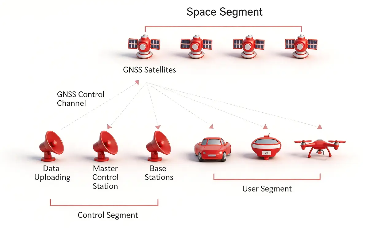
Space Segment
United States
GPSGlobal Positioning System
27
Russia
GLONASSGlobalnaya navigatsionnaya sputnikovaya sistema
24
European Union
GalileoEurope's own global navigation satellite system
27
China
BeiDouBeiDou Navigation Satellite System
35
Japan
QZSSQZSS Navigation Satellite System
3
India
IRNSSIndian Regional Navigation Satellite System
7